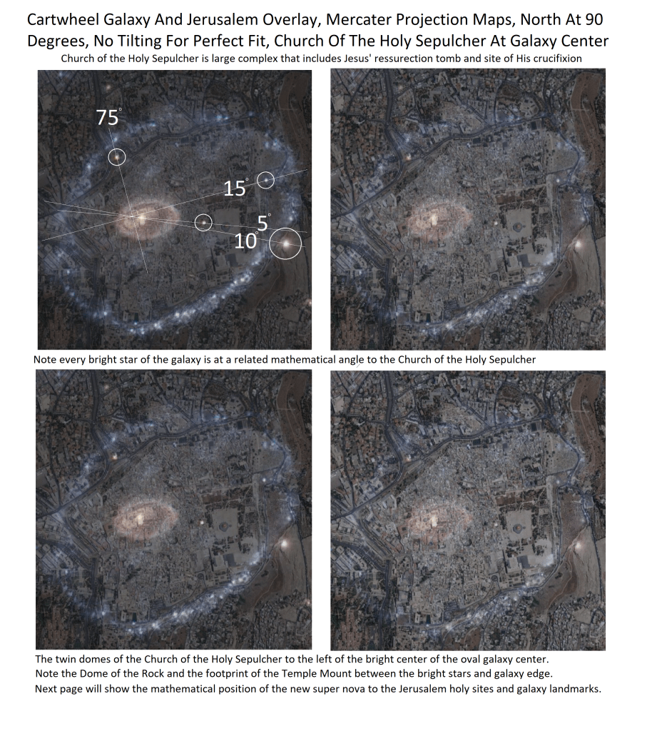
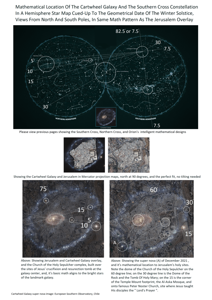
Showing God's mathematical pattern of Earth's geological and historic features,as well as that same pattern in the Heavens, Proving that Jesus was/is God's Son, and, that the prophets and stories of the world's religions and tribes are of God
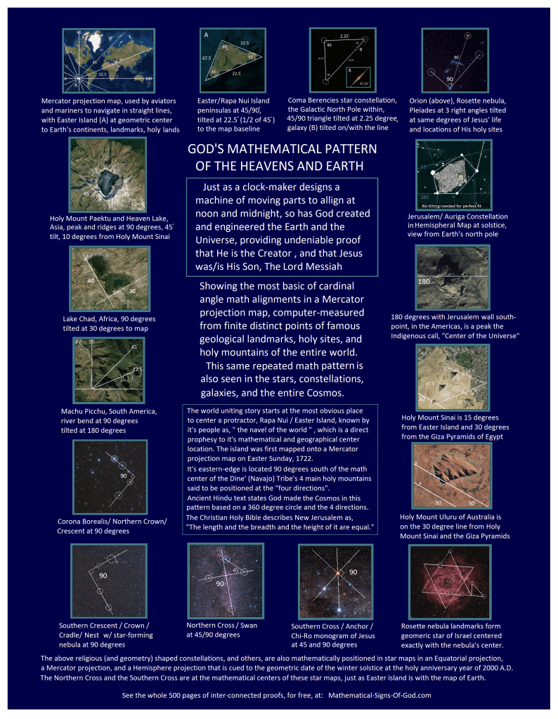
God’s Math Pattern Of The Heavens And Earth
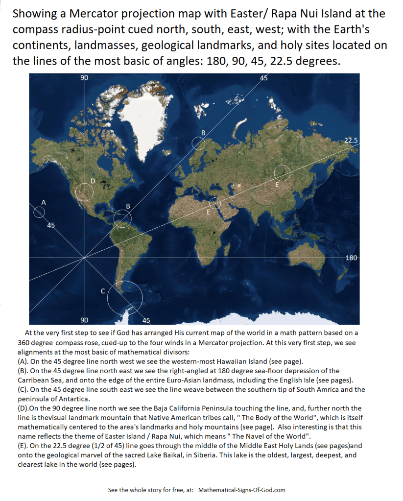
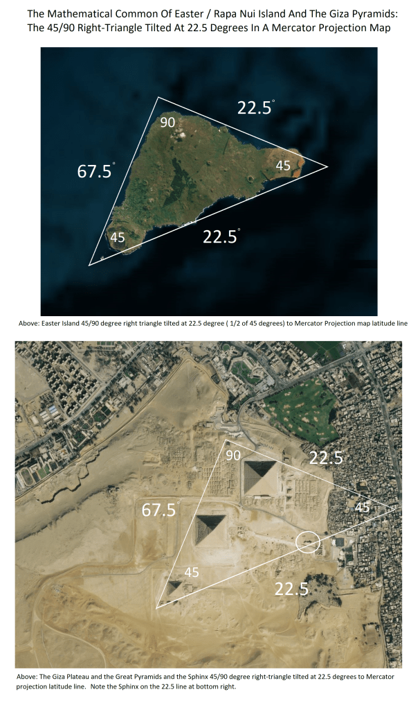
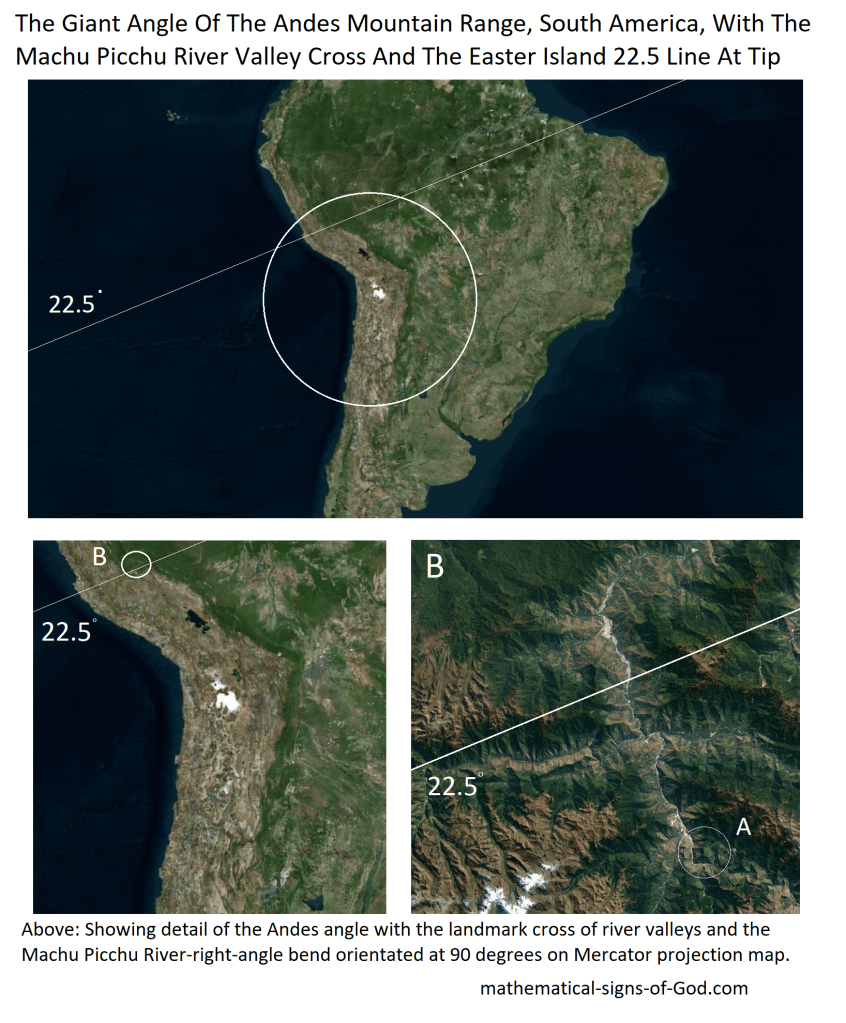
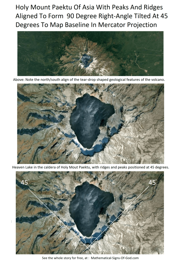
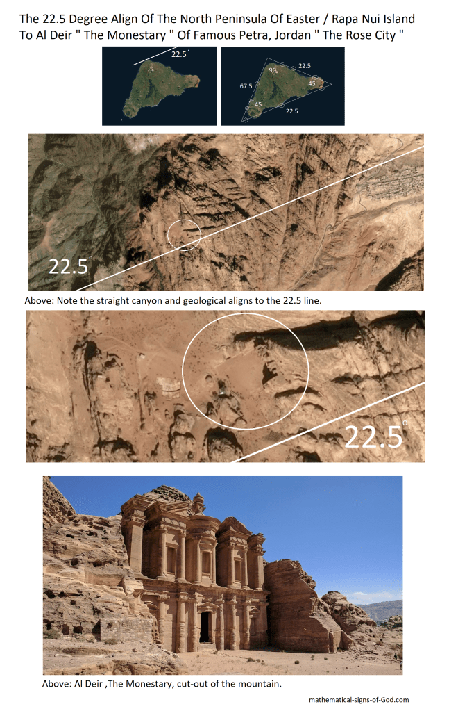
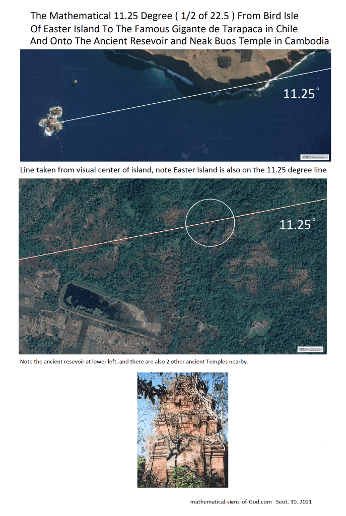
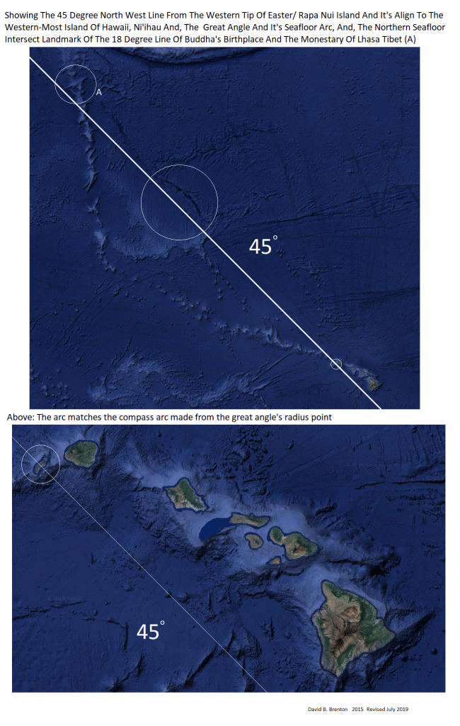
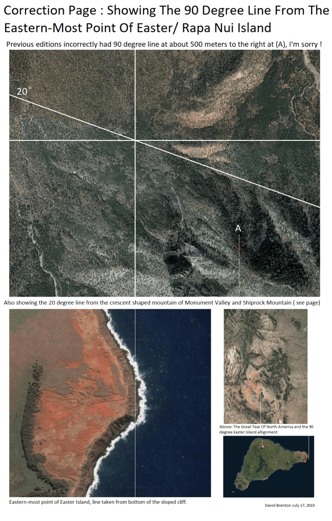
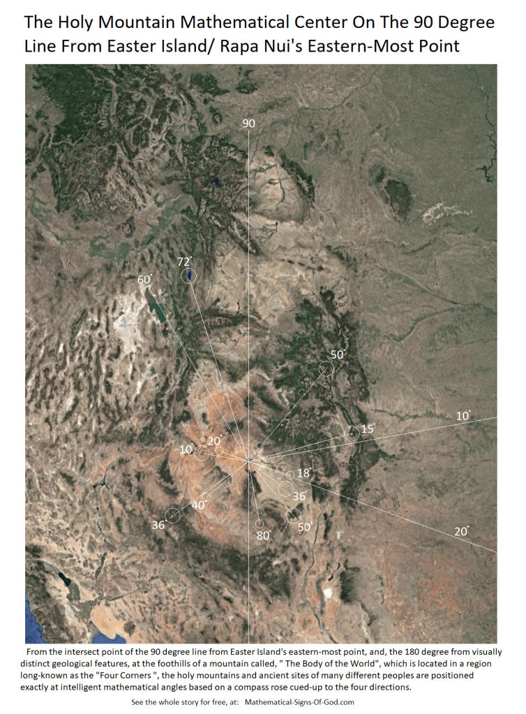
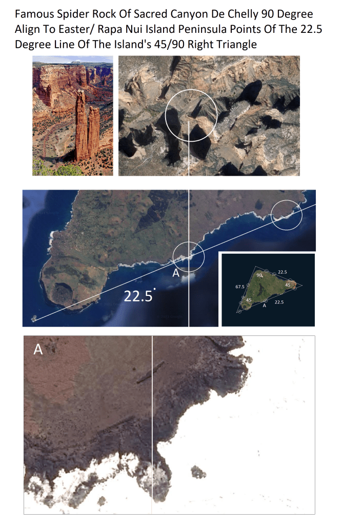
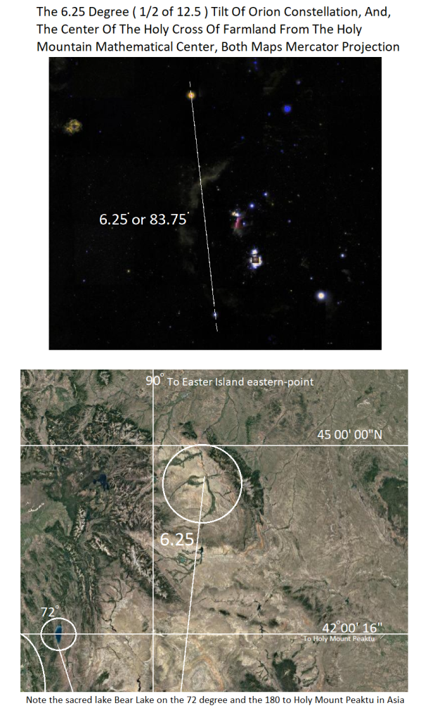
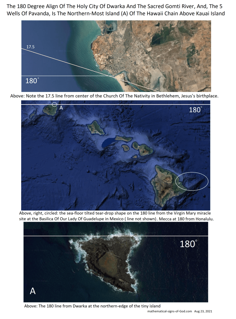
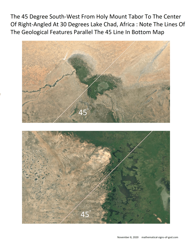
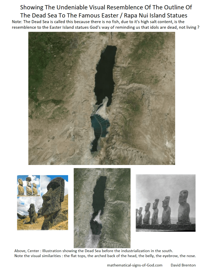
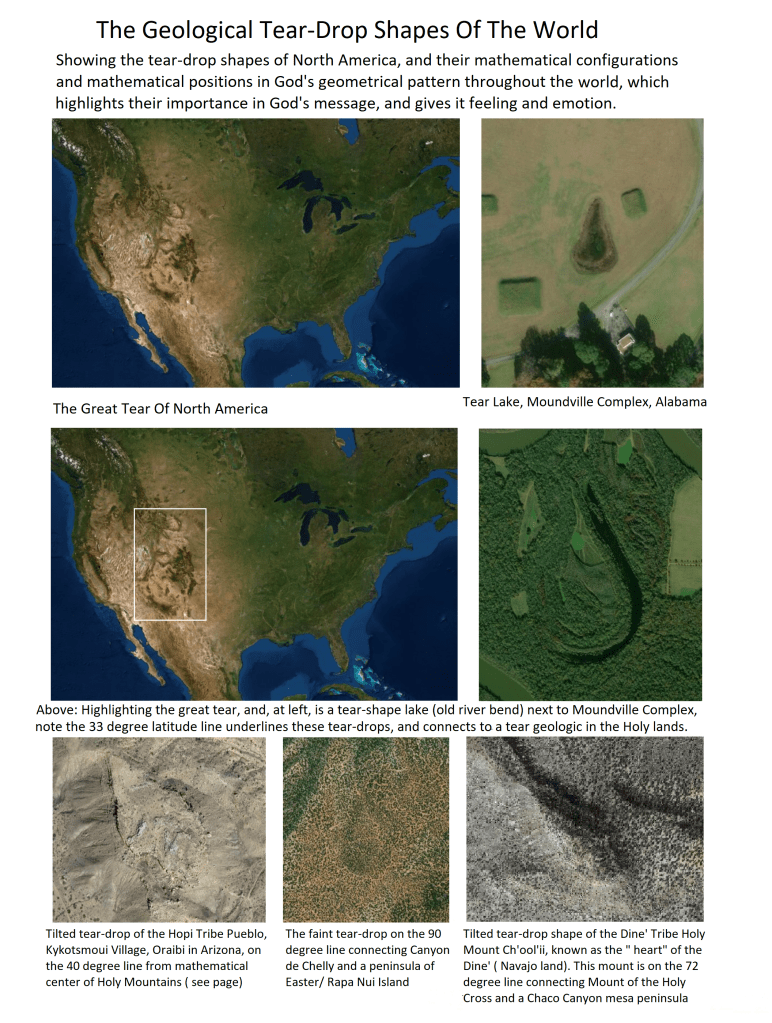
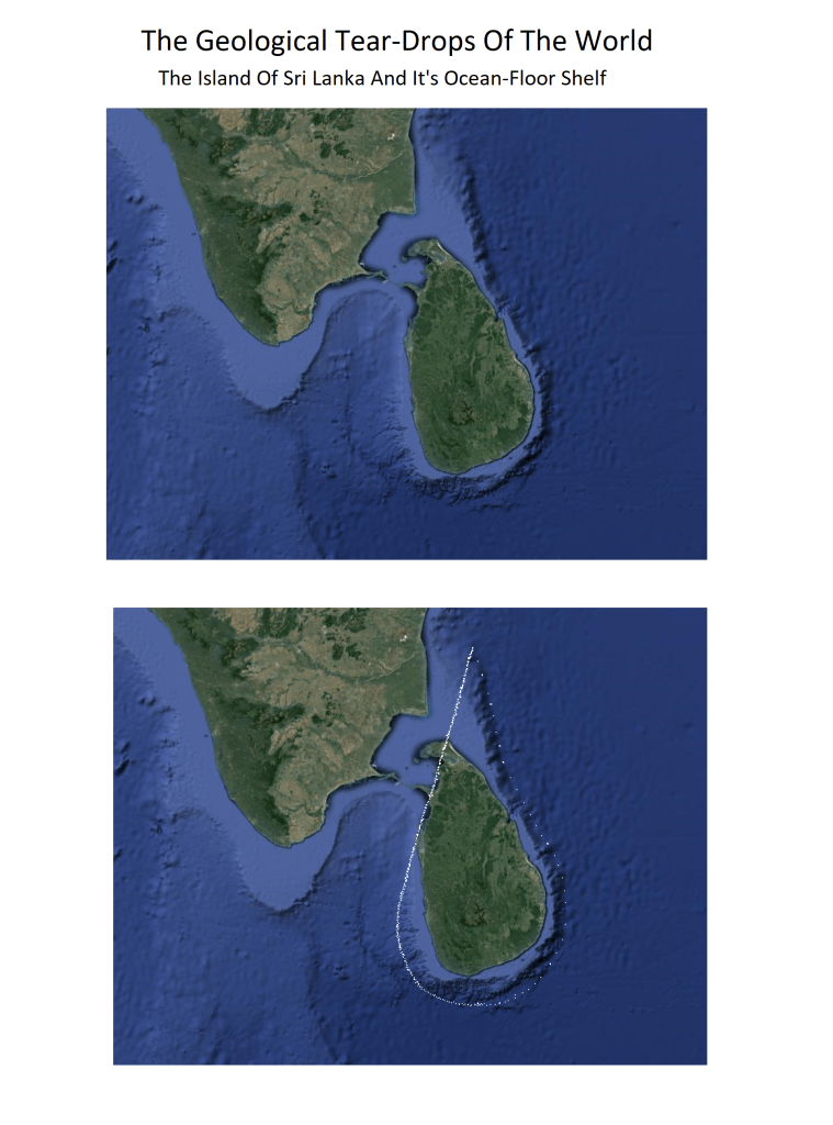
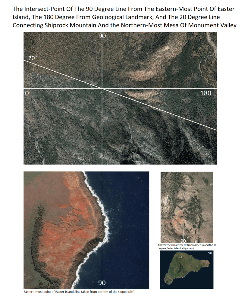
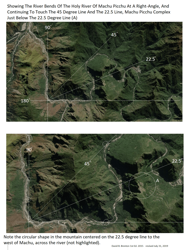
Above: World famous Easter/ Rapa Nui Island, first mapped in a Mercator projection map on Easter Sunday in 1722, shaped as a carpenter’s square, 45/90 degrees tilted at 22.5 ( 1/2 of 45) to the map’s baseline, Earth’s equator. Above, Top: Big area map: Note the southern tip of South American continent, and the European/Asian landmass on the 45 degree lines from the ” Navel of the World “. Note the Hawai’i islands on the 45 NW. Note the Baja Peninsula on the 90 degree north line. Note the Holy Lands, The Caspian Sea, and the Sacred Lake Baikal on the 22.5 degree ( which is 1/2 of 45 degrees). Note Lake Victoria, Africa and the southern tip of India and the island of Sri Lanka on the 11.25 degree line ( 1/2 of 22.5)After reviewing this opening proofs scroll, be sure to view the blog posts for new findingsAbove: In 2 ways the plate-shaped Galaxy aligns, in it’s tilt on edge, AND, it’s angleAbove: Note the 30 degree of the Sinai Wilderness Arrow is mathematically related to it’s 15 degree alignment to Easter/ Rapa Nui Island. Take note of it’s tilt at 25 and 55 degrees, we will see these angles repeated in famous locations around the world.Below: The 22.5 degree from Easter Island’s 22.5 aligned southern peninsulas, continued…Below: The 11.25 degree ( 1/2 of 22.5 degrees ) from Easter IslandAbove: Note, the ancient Hindu design system called, Vastu, which is used by architects, interior designers, and landscapers, based on arranging things at the four directions of a 360 degree compass, exactly as seen in God’s signs. Above: The Holy Bodhi Tree ( in circle) is just above the line, but, if the lines of the Easter island 45/90 triangle is moved a line’s thickness, the line can be exactly right to the tree. Above: The 22.5 line continues points directly to the same cross of holy rivers at Machu Pichu that is on the Easter Island/ Rapa Nui Island 22.5 line ( shown in page at top )Above: This 18 degree aligned sea-floor mountain is (A) on the map at pages above, at the north tip of the Hawaii Volcanic Chain angle.Below: The 45 north west from Easter Island.Below: The 90 Degree line north from Easter / Rapa Nui Island, known by it’s people as the ” Navel of the World”, from the eastern-most point, to the foothills of a mountain known by the Dine’ Tribe as ” the Body of the World”.Below: Note the picture frames the giant tear-drop shape of the Rocky Mountain plateau.
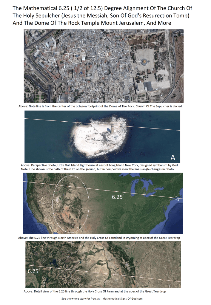
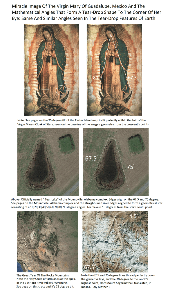
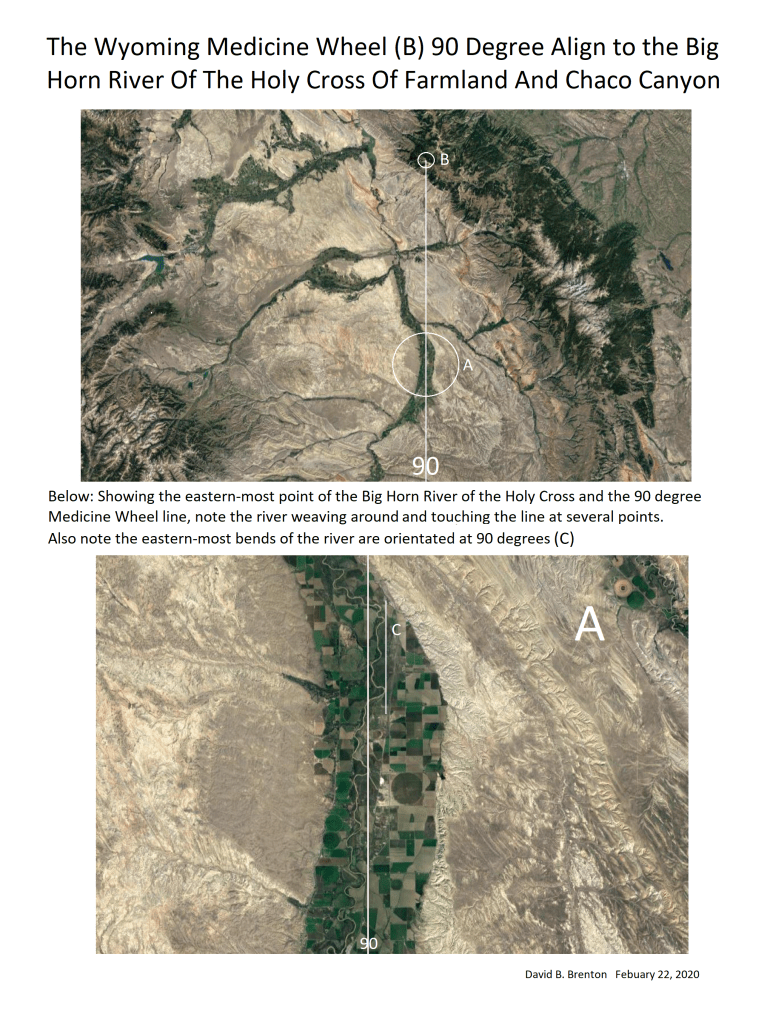
Note the Holy Cross of Farmlands of the Big Horn River, Wyoming at the tear’s apex, on the 45 00′ 00″N line.
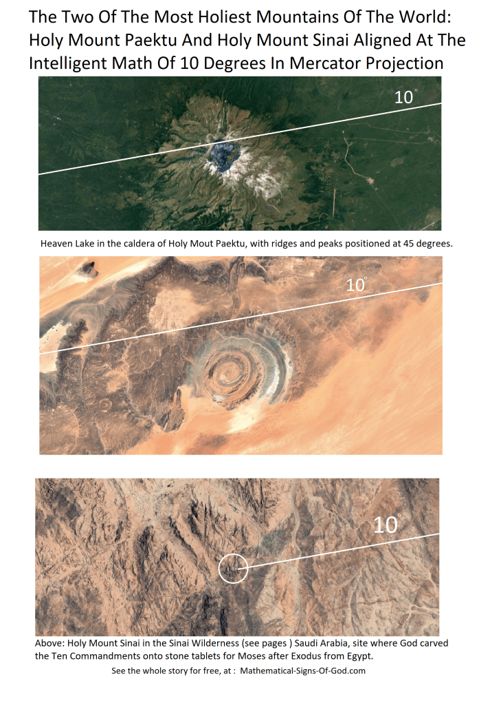
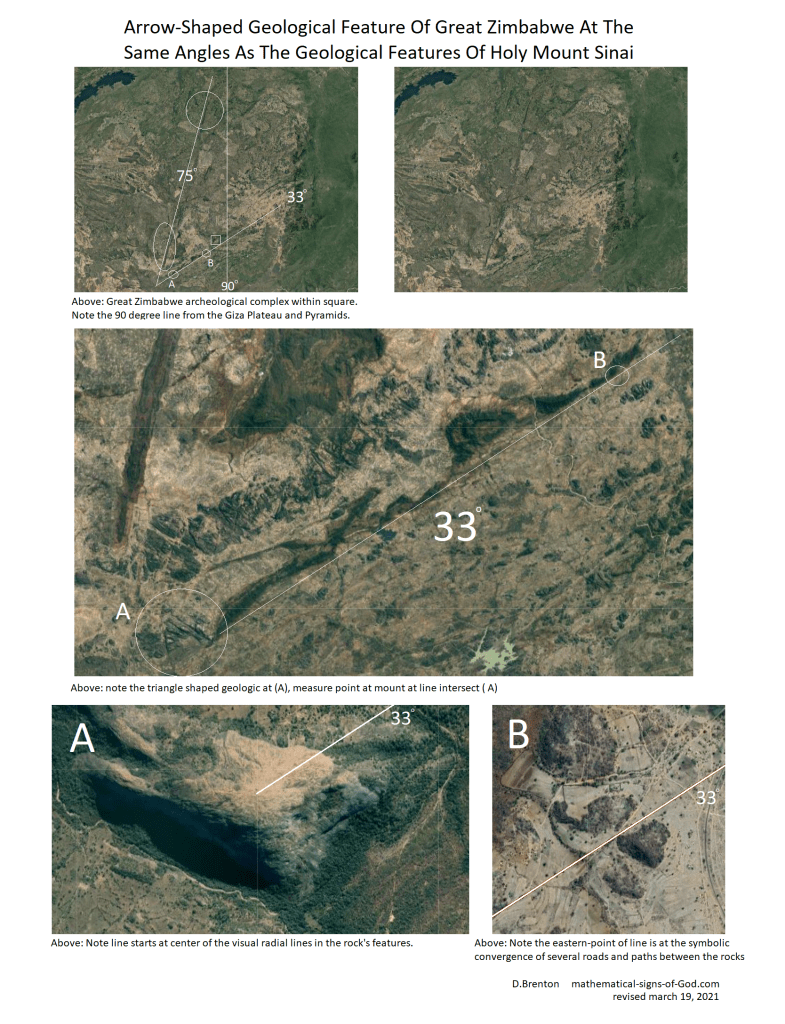
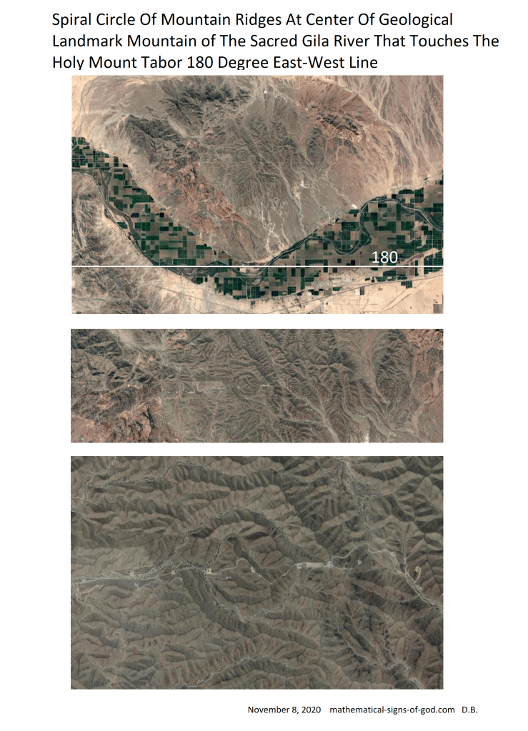
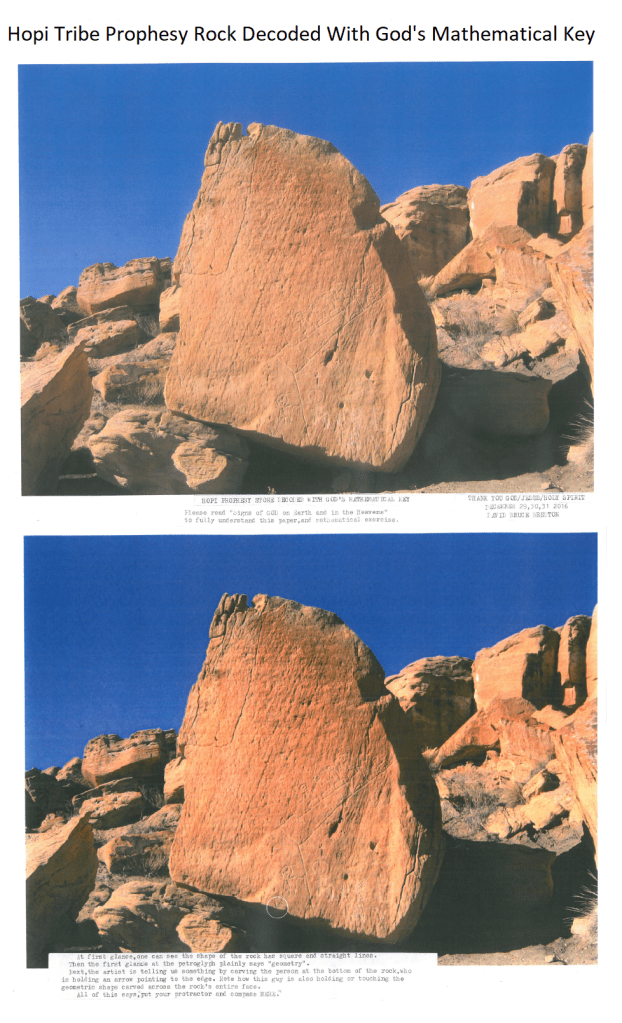
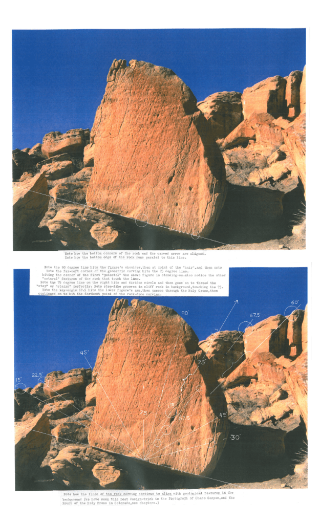
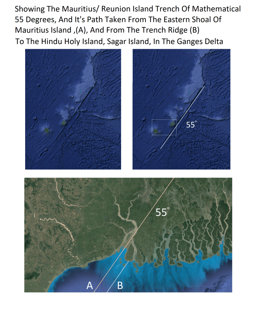
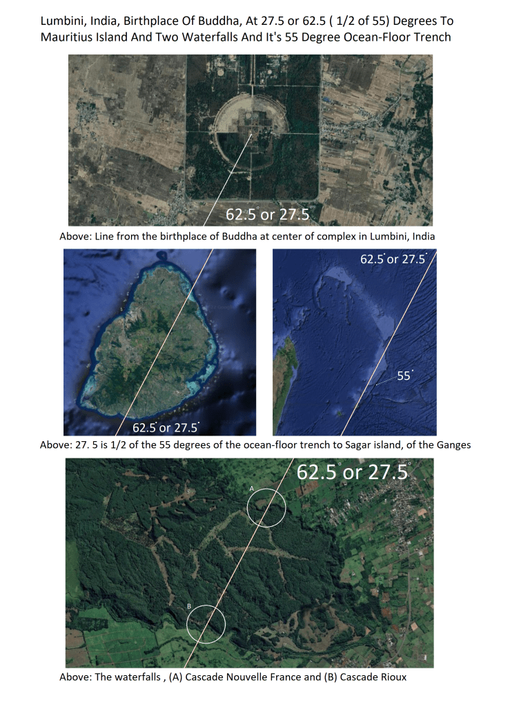
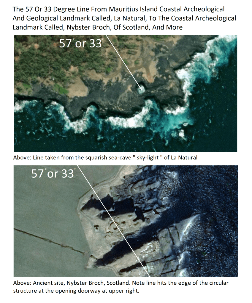
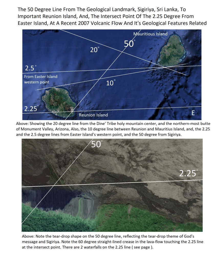
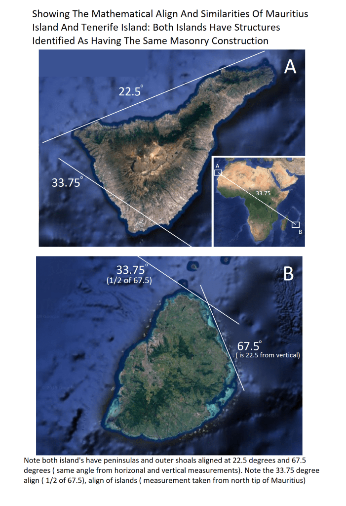
Above: See pages showing the 40 degree align of Sunset Volcanic Crater and Meteor Crater and Wapatki Archeological siteAbove: Be sure to view the chapter on God’s geometry in the Hopi Prophesy Rock Above: Another mathematical alignment with a ” modern ” structure, the ancient Aztec center is at top and to right of the plaza.Above: Be sure to view the most interesting chapter on Mauritius Island and Reunion Island, and their mathematical location to just about every Holy place of the world’s peoples. Example: The islands are 67.5 degrees from the Dome of the Rock, Jerusalem and Mecca, and, Reunion Island is 67.5 degrees From Holy Mount Sinai. At 45 degree from Mauritius’ highest peak is China’s Holy Mount Tai. At 55 degrees is the Hindu Holy Island of Sagar at the mouth of the Holy Ganges River. At 180 degree is Great Zimbabwe archeological complex in Africa. And, the islands are 2.25 and 2.5 degrees from Easter Island.
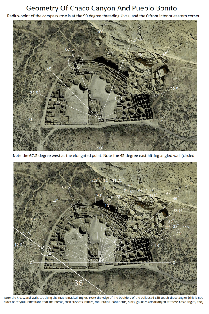
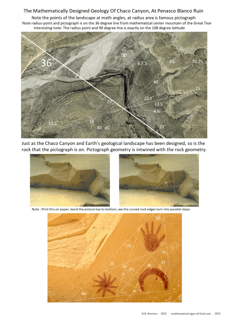
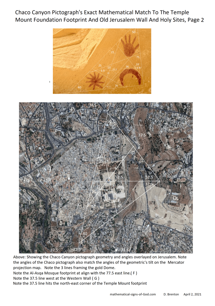
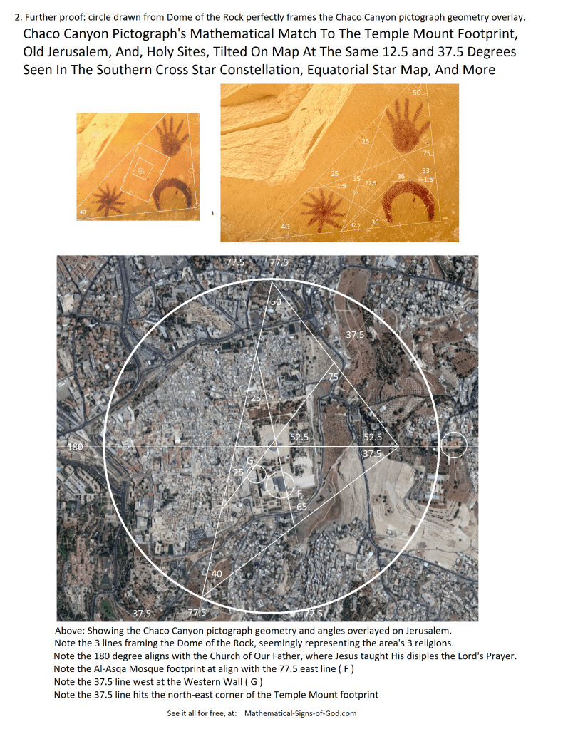
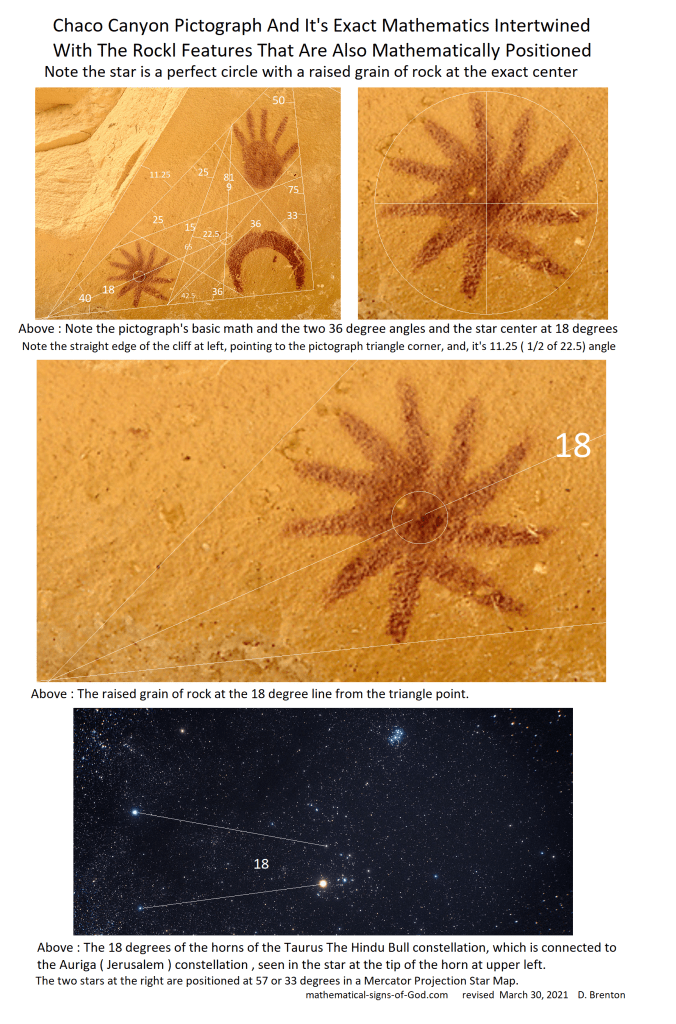
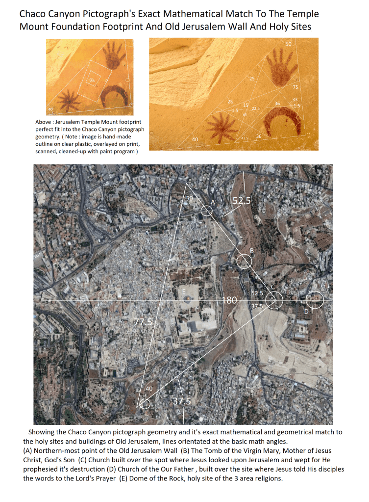
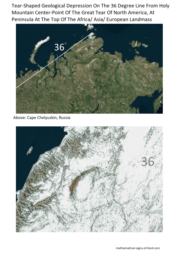
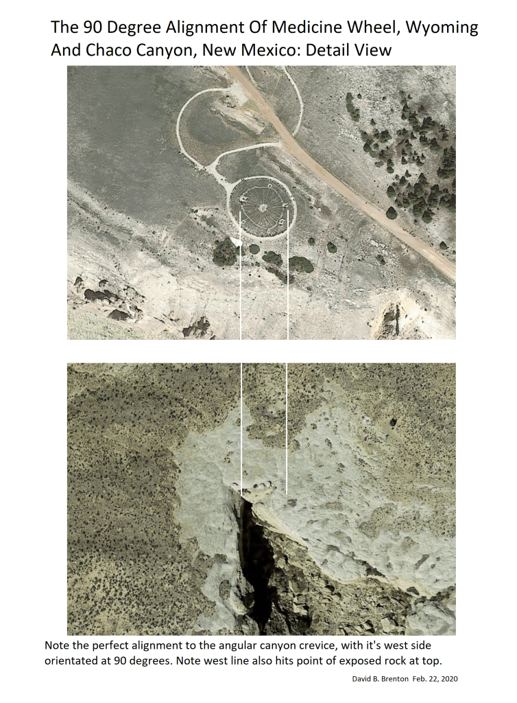
Below: Chaco Canyon, on the 36 degree from the Native American Holy Mountain mathematical center
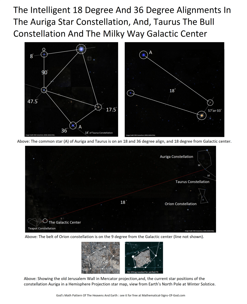
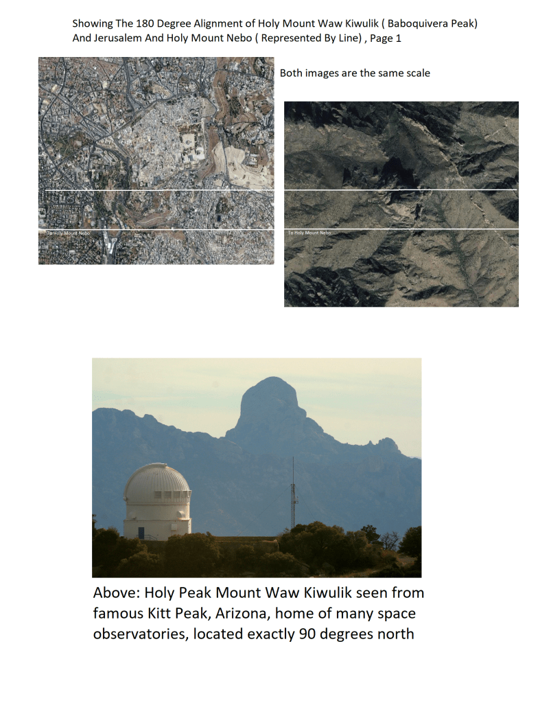
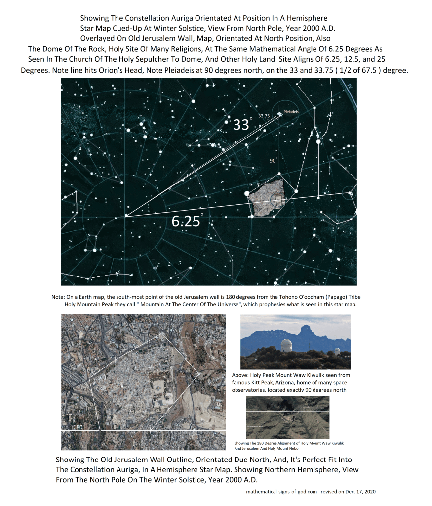
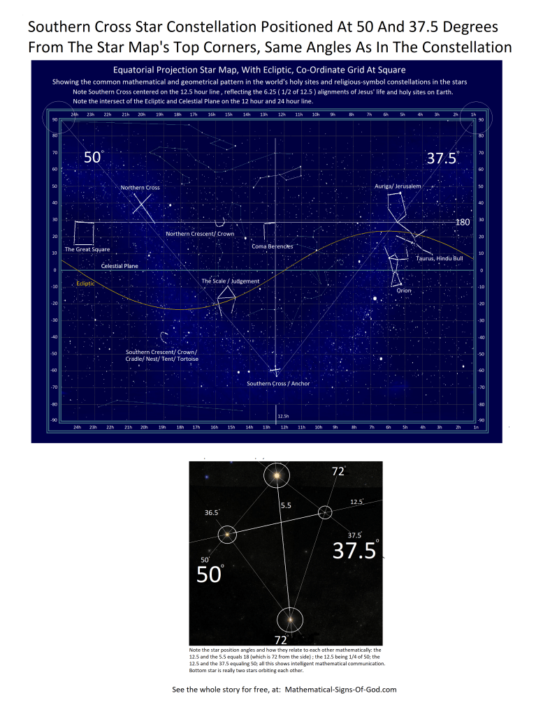
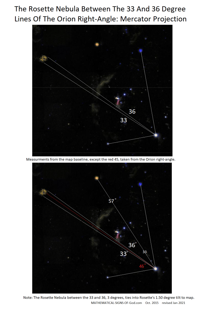
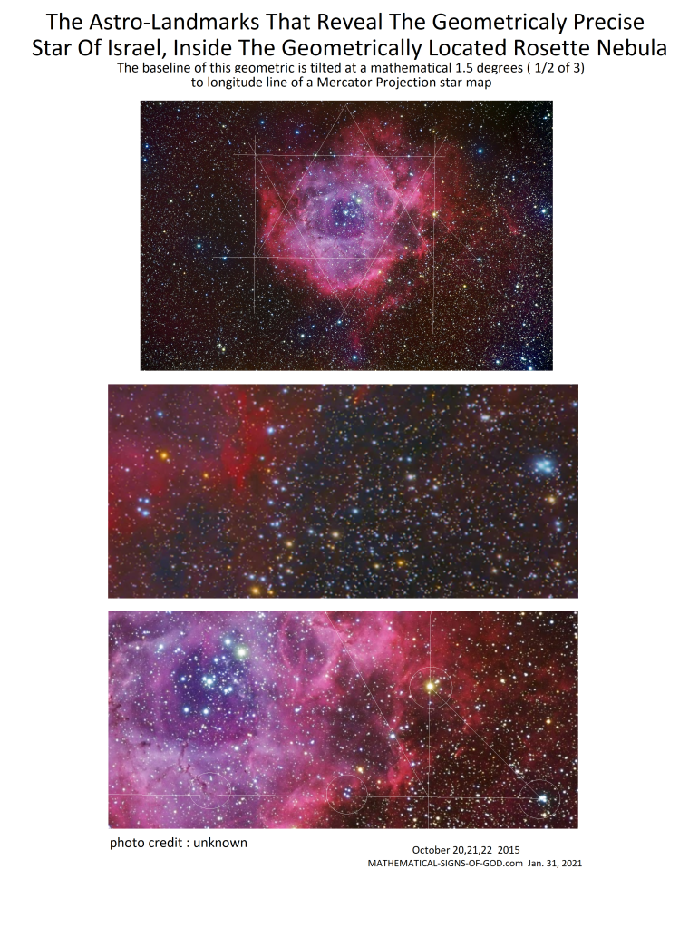
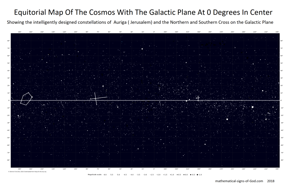
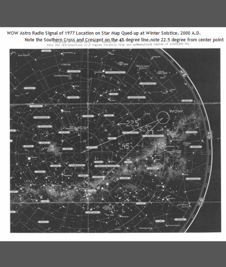
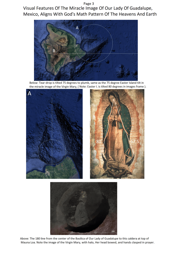
Above: Not shown is the 81 degree ( multiple of 9 ) line connecting hand and crescent.Above: Note the raised grain of rock at the exact center.Below: Showing the 180 degree align of the Tohono O oodham Tribe’s ” Mountain at the Center of the Universe ” and the southern-most point of the Old Jerusalem Wall.Below: From the southern tip of the old Jerusalem Wall to the strange-shaped peak in Arizona, called by the Tohono O ‘ oodham Tribe, ” The Center of the Universe “Above: Note the peak’s shape resemblance to the space observatory from this angle.Below: The Jerusalem Wall and Auriga in a detail of the Hemisphere Projection Star Map at the winter solstice, views from the north and south poles, and the southern tip of Jerusalem touching the star map’s 180 center line.Rosette Nebula is between the 33 degree and the 36 degree line. More on Orion and the Rosette Nebula and Pleiades further down the scroll. Below: Note the Southern Cross on the 12.5 hour line of the Equatorial Star Map.
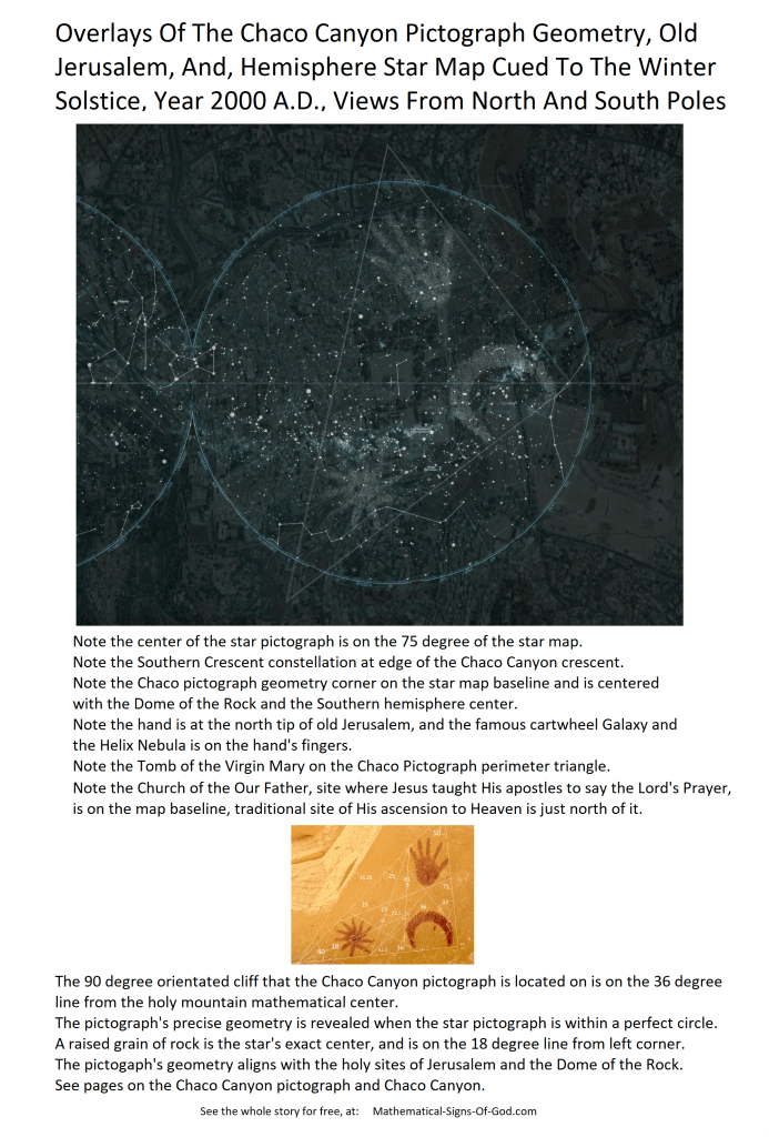
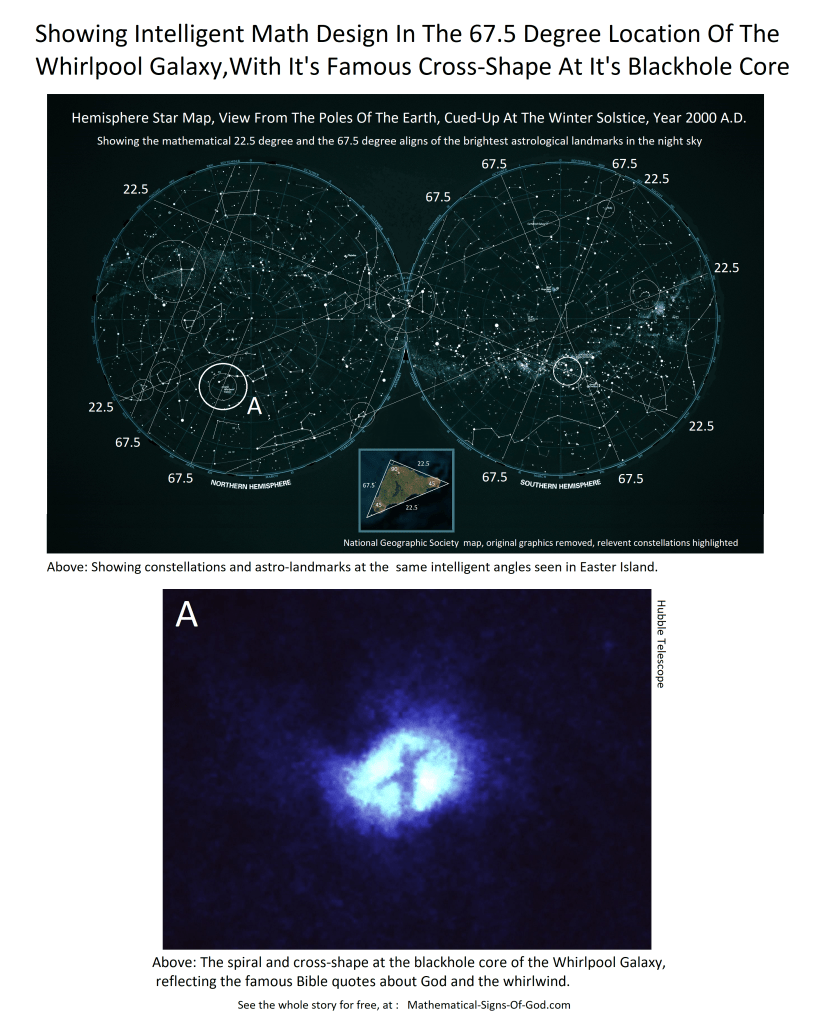
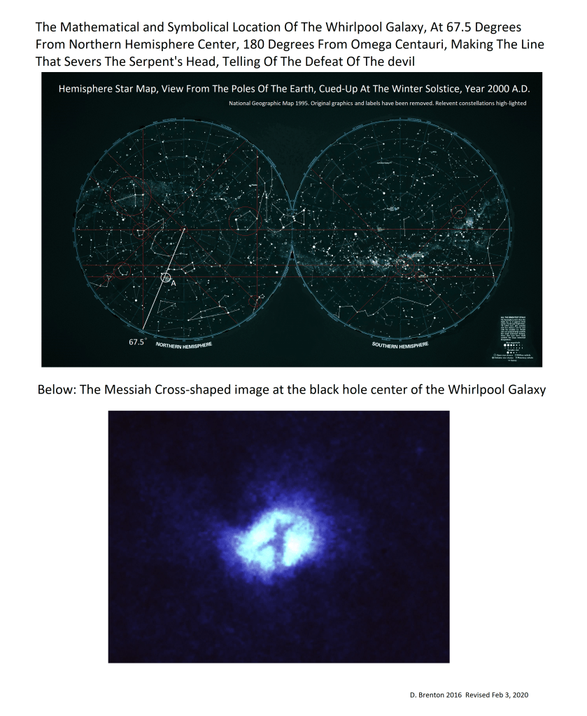
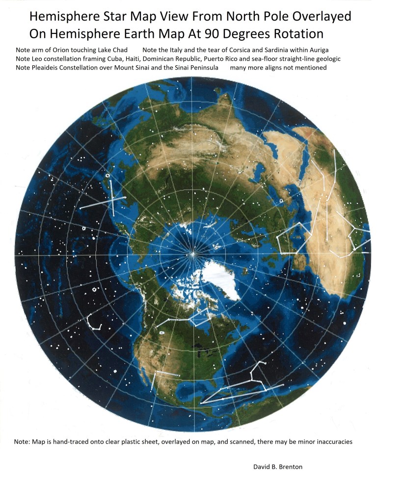
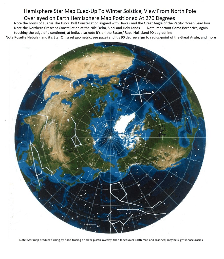
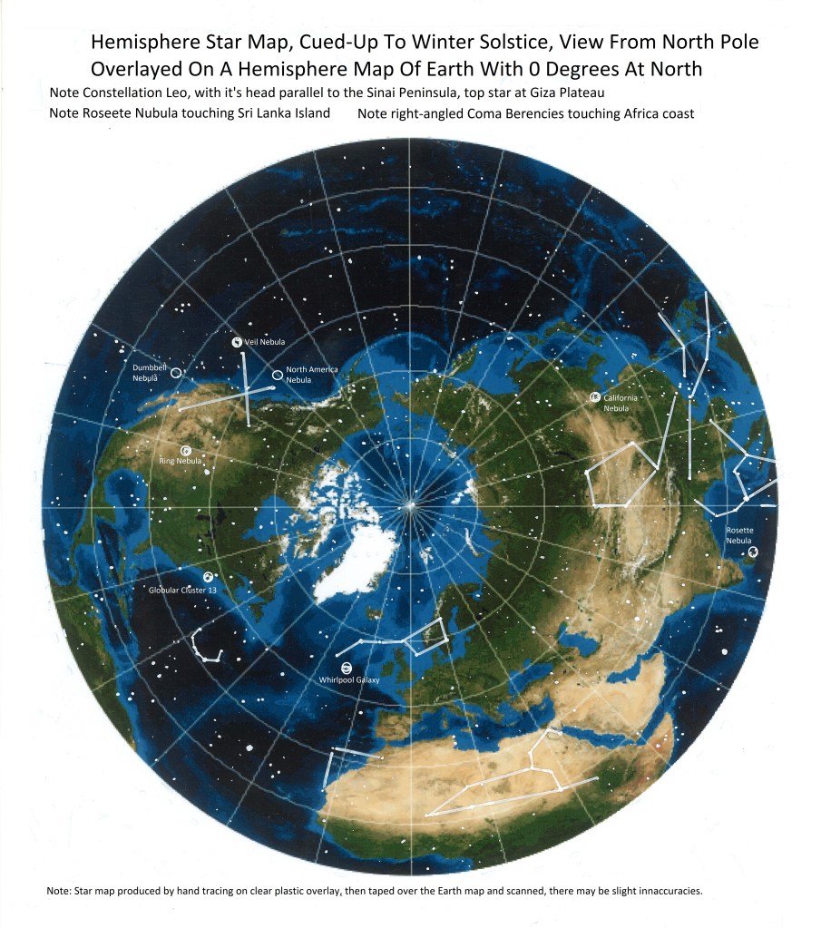
This National Geographic map ( with original labels removed ), is cued-up to the mathematical date of the winter solstice, the year 2000, with views from the north and south poles.
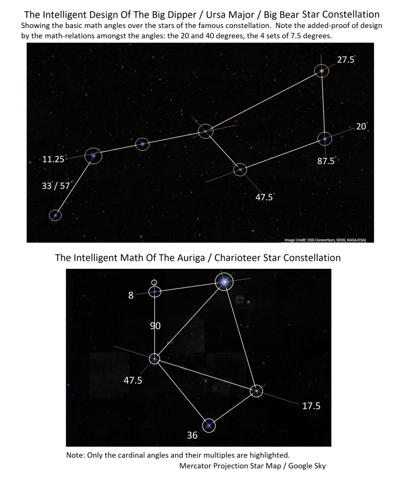
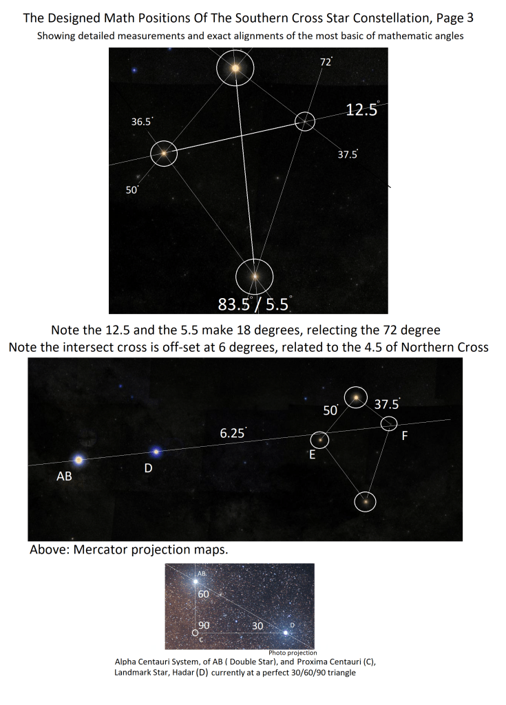
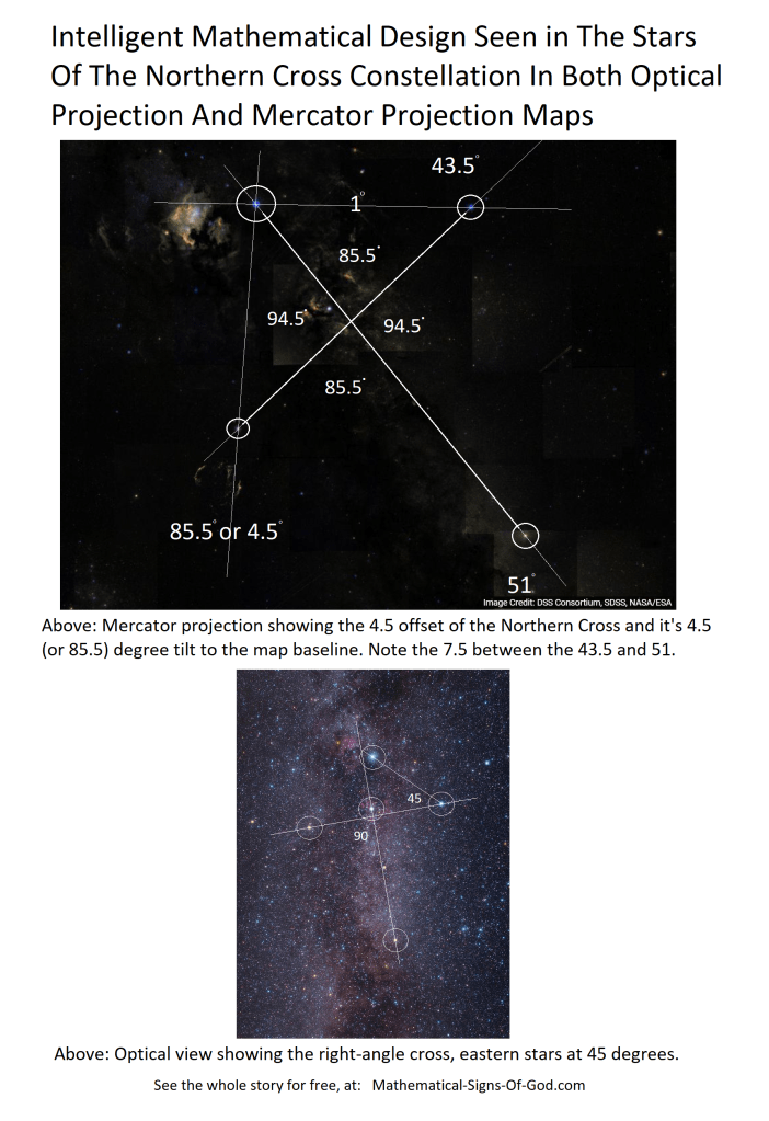
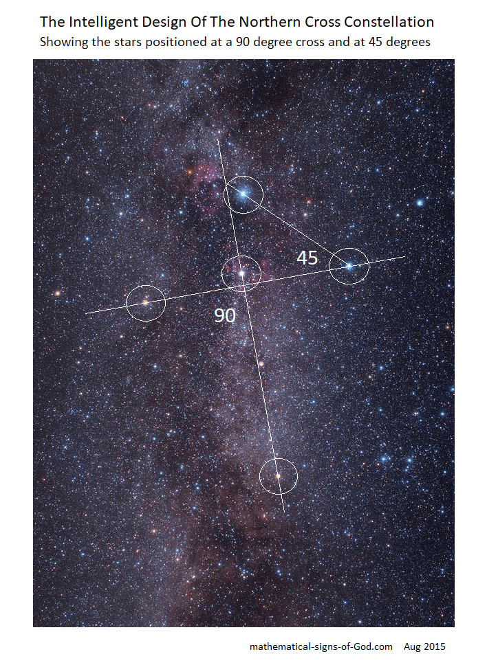
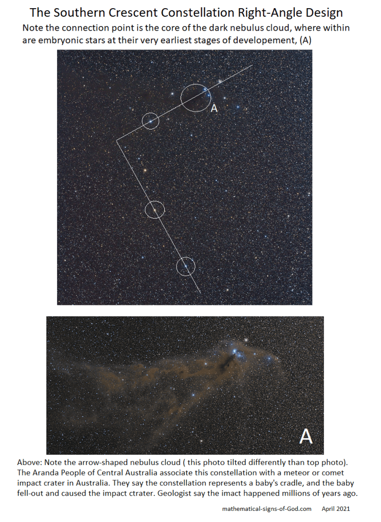
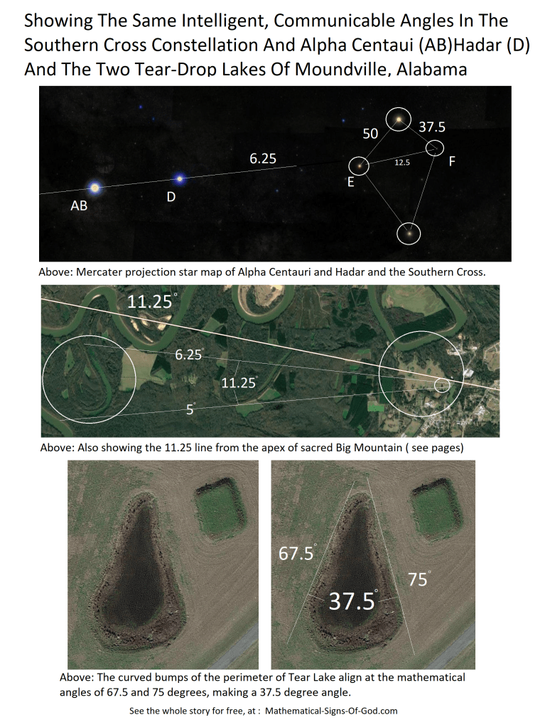
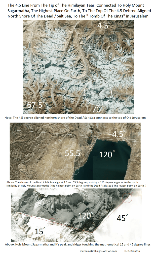
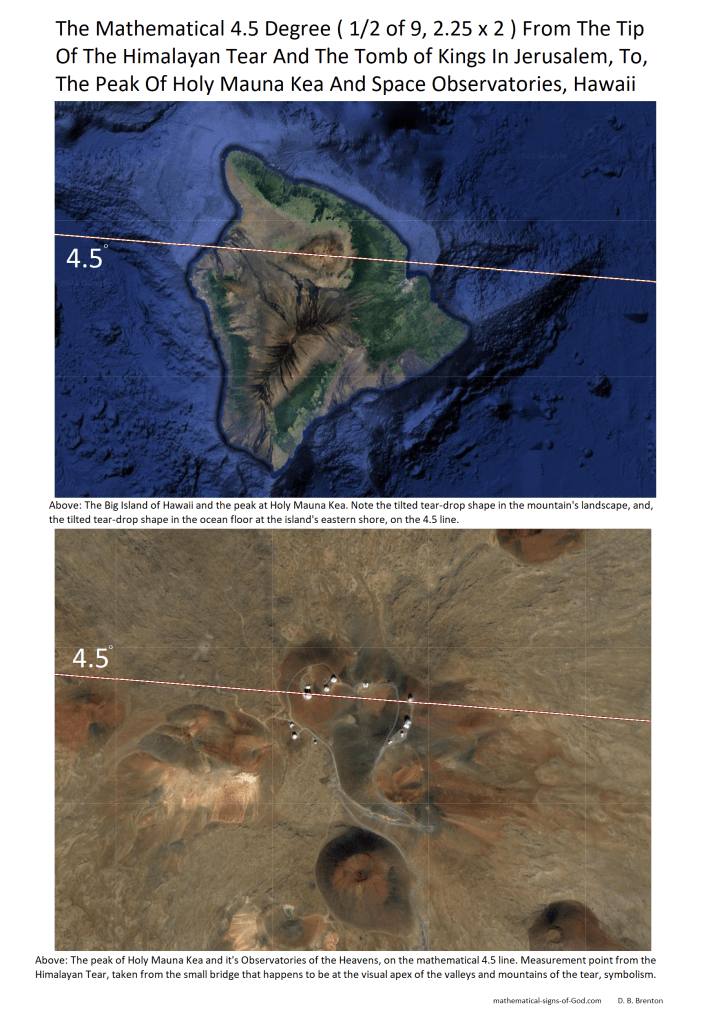
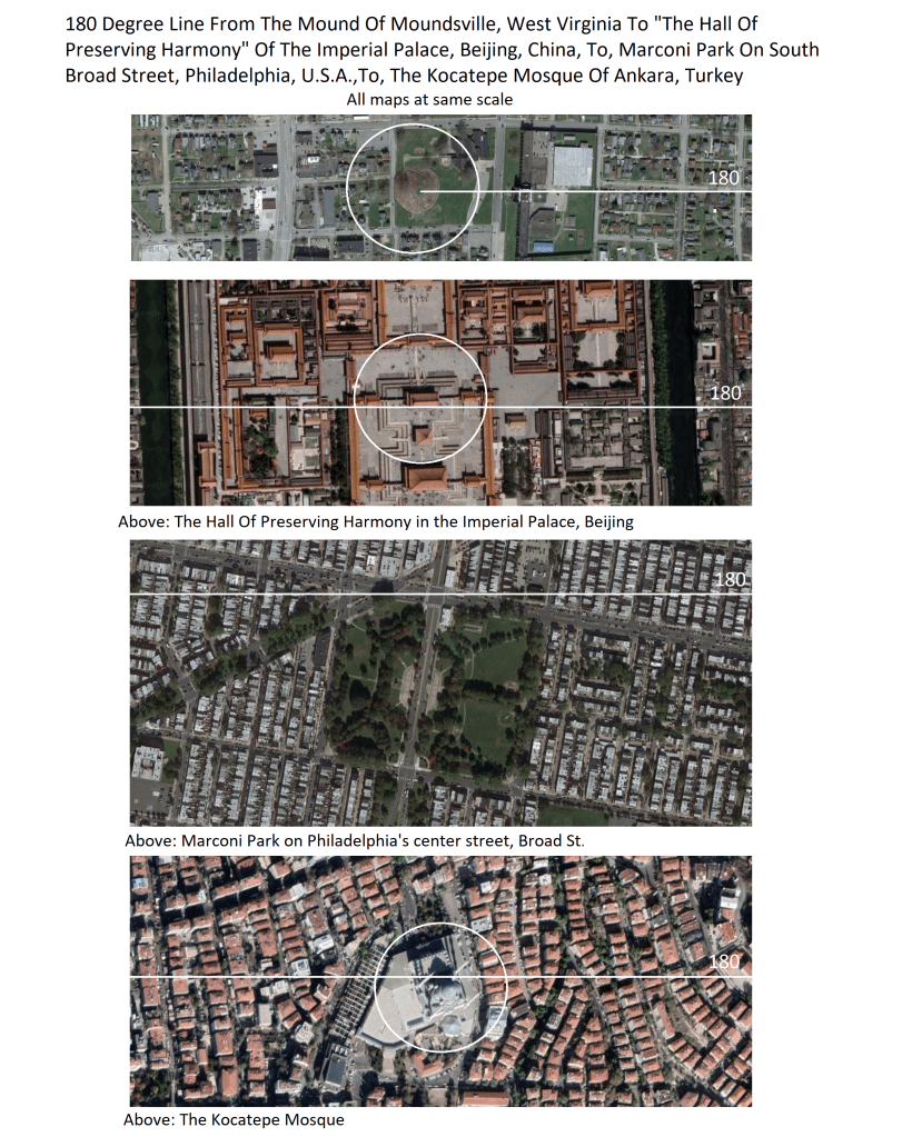
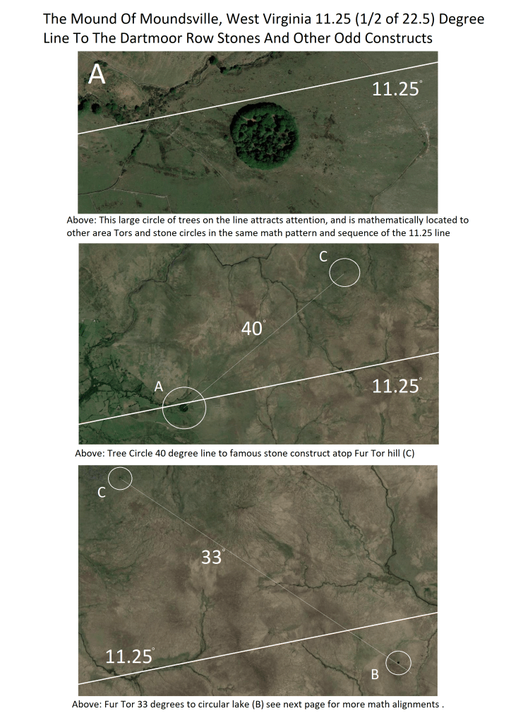
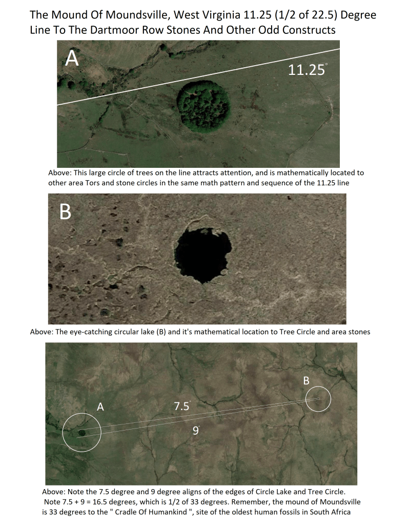
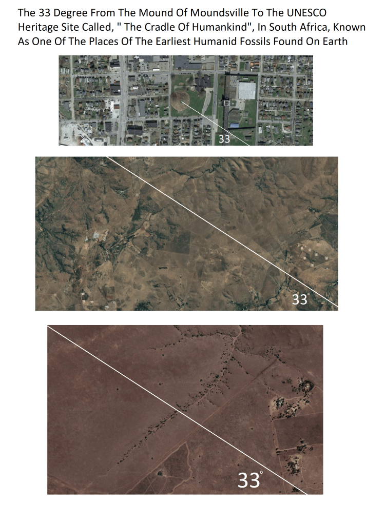
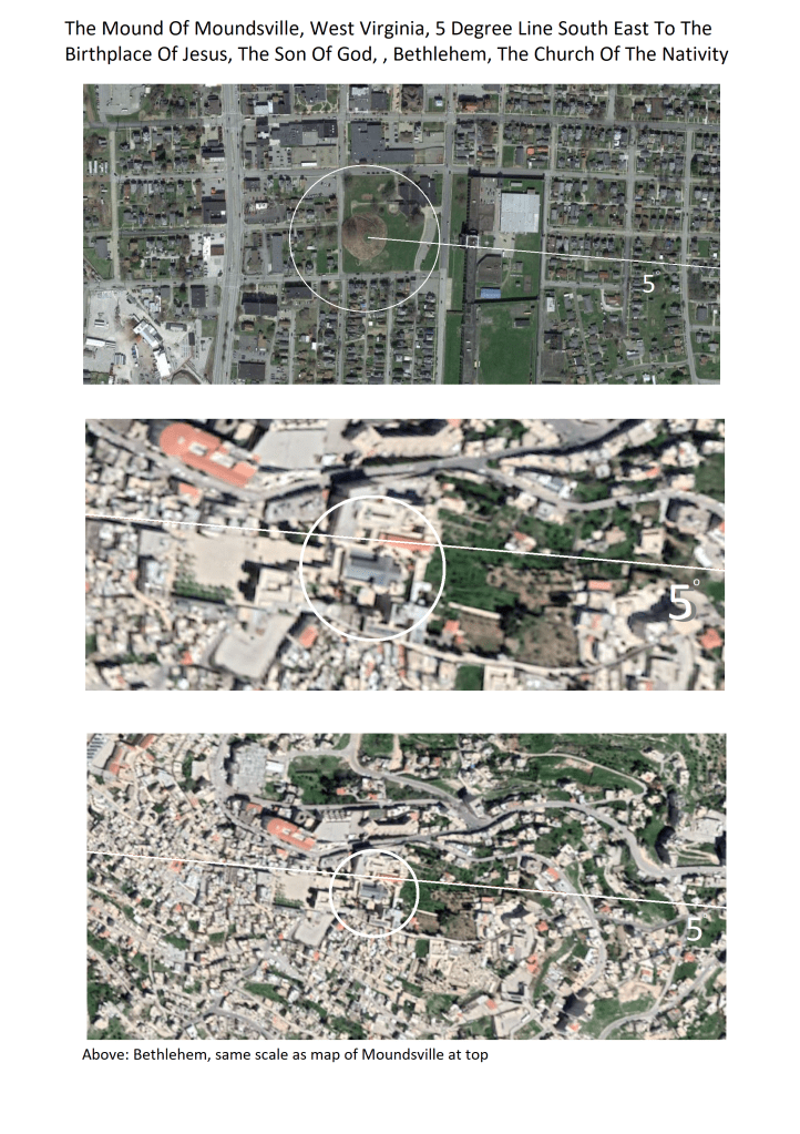
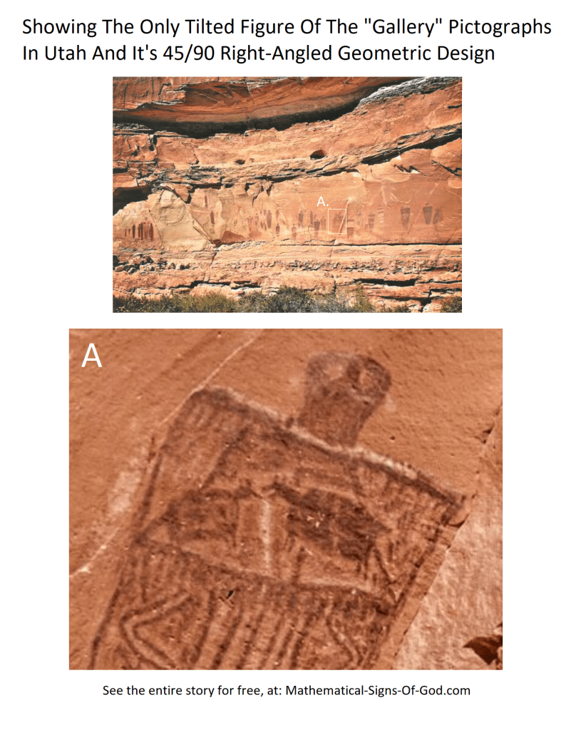
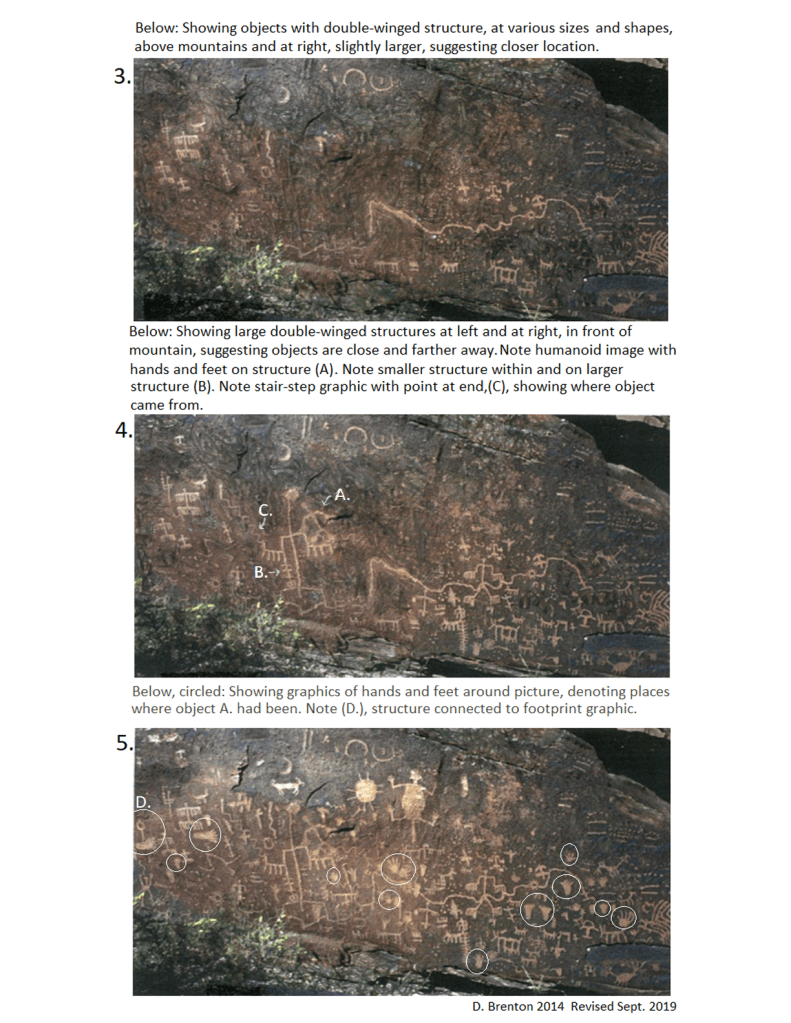
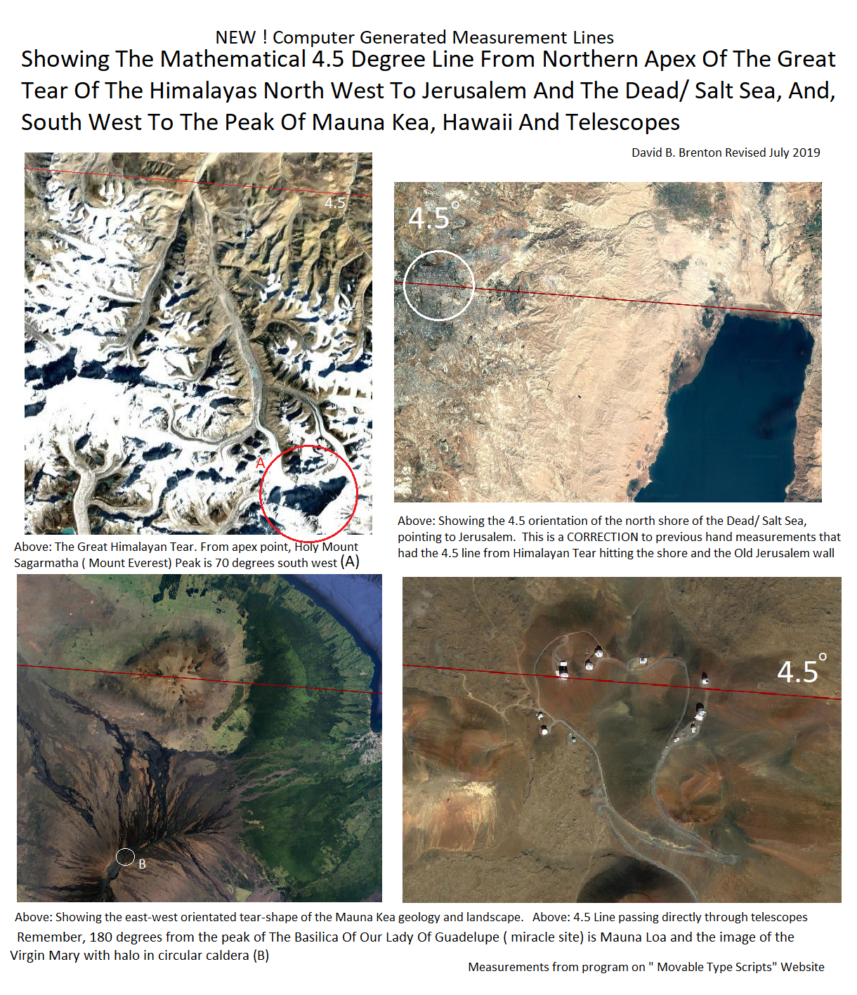
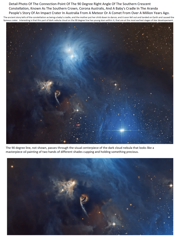
Below: The right-angles of The Northern and Southern Cross, and, the Northern and Southern Crescents ( Corona Borealis and Corona Australis ) in photographic projectionAbove: This constellation has it’s own chapter that shows a common theme that unites the peoples of the world, seen at the “blog posts” of this site.Below: Another example of the proof and connection of the UFO sightings and God’s mathematical pattern ?Below: The same symbols of the famous religions of the cross and crescent seen on Earth at basic mathematical locations is also seen in the Heavens.The same basic math angles seen on Earth are seen in the Heavens. Note the math sequence of 5, 7.5, 15, 30, 60Be sure to view all the pages on the mathematical alignments from Holy Mount TaborSee pages showing the 40 degree line from the holy mountain mathematical center to the river canyon of this Hopi village.Above: Note the step symbol is seen throughout God’s pattern in the following pages.Above: The line shown is taken from a small bridge at the tip of the Himalayan TearBE SURE TO VIEW BLOG POST FOR NEW AND RECENT FINDINGS AFTER YOU READ THIS STORYAbove: The 15 degree line passes directly over Dr. Rev. Martin Luther King Jr.’s Ebenezer Baptist church and also Morehouse college where he received his degree in SociologyBelow: The Story Of Mauritius Island and Reunion Island, on the 20 degree from the Native American Holy Mountain mathematical center:Ancient Alien Spaceship Armada Landing In Desert Recorded At Newspaper Rock, Arizona Solid ProofAbove: Be sure to see the chapter on the amazing math alignments of Moundville, West VirginiaAbove: Note the boulder teetering on the steep slope in front of the whole scene.
Note it’s shadow says that it’s right side, at least, is a thin sharp edge, which suggest it could be a shatter-point rock, knocked off by impact or weathering, and it landed and rolled to this spot.
How has it not fallen over, being so thin ? If we go by what science says, this event happened thousands of years ago, which makes one wonder why this has not blown-over, or moving sand slowly pushed it over.
The shatter-point rock-chip boulder also symbolically suggests the very claim as to why we are looking at this scene, ” are these geometric shapes in the rock carvings ? Because, this boulder is the same thing, and shape, as the rock-chips made when carving stone.
As if to say, ” yes, that is intelligent design and rock-shaping you see in the background.”
Note: Not all pages of proofs shown , also view blog post ( posted in no order) , be sure to get the print version for best experience.)
Also important to note : This is “Phase 1” of these findings, where just the basic cardinal angles and their simple divisors are being explored, the way in which everybody can understand and proof be established. Keeping this simple is the name of the game. I do believe there is a more complicated math in here, but, for now, I feel if the connections get too complicated, people will not believe it. Also, this is just the beginning findings, and not all of the world’s sites have been covered, and many important sites are only known by locals, so, if you do not see a particular site that you know, please contact.
Below: The Bering Sea Crescent and the intelligent math of the Hawaiian/ Emperor Volcanic Chain
View the blog posts for more pages and chapters not listed here.