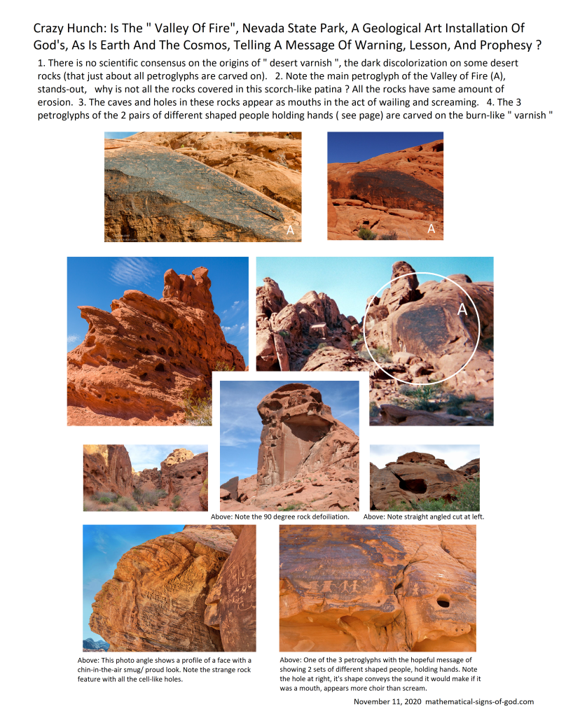
See center picture of rock outcrop with right-angled and plumb “weathering” .
This is amazing , people !
See center picture of rock outcrop with right-angled and plumb “weathering” .
This is amazing , people !
On the 55 degree line of Sacred Camelback Mountain and the Casa Grande Ruins , and, the 22.5 from Newspaper Rock


The available map for Easter Island just got more detailed , you can zoom in and see statues now. I just found out. I wanted to see and measure these since the start of this in 2013 and 4. Christmas gift !
Thanks to the satelite map makers for making this road to Jesus God’s Son, and all the world’s prophets, and eventual peace, possible. Merry Christmas !
Celebrate till 3 kings day, at least. Keep the music and lights going till Super Bowl Sunday ! Jesus’s birthday needs more than 1 or 12 days of good cheer and celebration .
This proves the Oak Island story is a part of God’s riddle, and it is not about buried gold.
Oak Island mystery started with two kids seeing a glowing light on the island, where they found an old pulley hanging on a tree.
The pulley was a ruse , possibly a strategy of God, to get someone to dig there and uncover the mystery, making it a world famous place, so at a later date it could give its fame to give attention to God’s Cosmic Treasure Hunt, and Jesus is the treasure.
Who would bury a treasure and forget to take down the tell-tale pulley ?
Also, since this site was turned into a TV show, it opened itself up to being a focus of all sorts of funny business; such as the possibility of ” planting” of objects and artifacts, done by pranksters or a tv executive or a crew member, wanting the show to continue, anything is possible.
This is why we now must question all these artifacts they find.
Also , do not like how historic evidence is handed-out in bits, week by week, just to get viewers and advertising. Imagine if all archeological sites were treated this way ? It would hinder human progress
All is meant to be, though, maybe the fame of the show will get people to listen to these findings here.
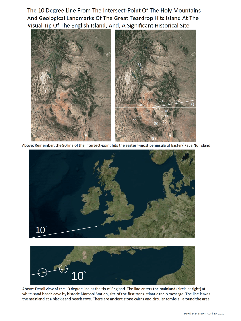
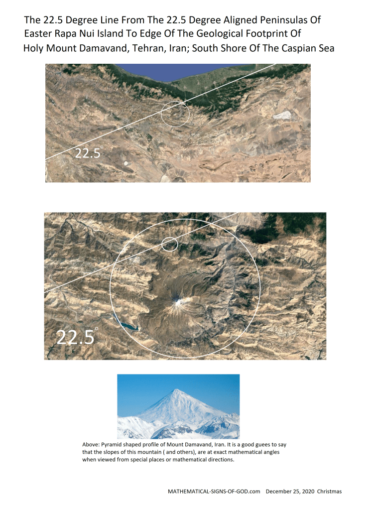
Measurements taken from the Northern-Edge Coast Of Easter Island and the 22.5 Degree aligned Southern Peninsulas, the lines also go through Baghdad, Iraq and Tehran, Iran and the northern geological edge of the Holy Mountain of Tehran.
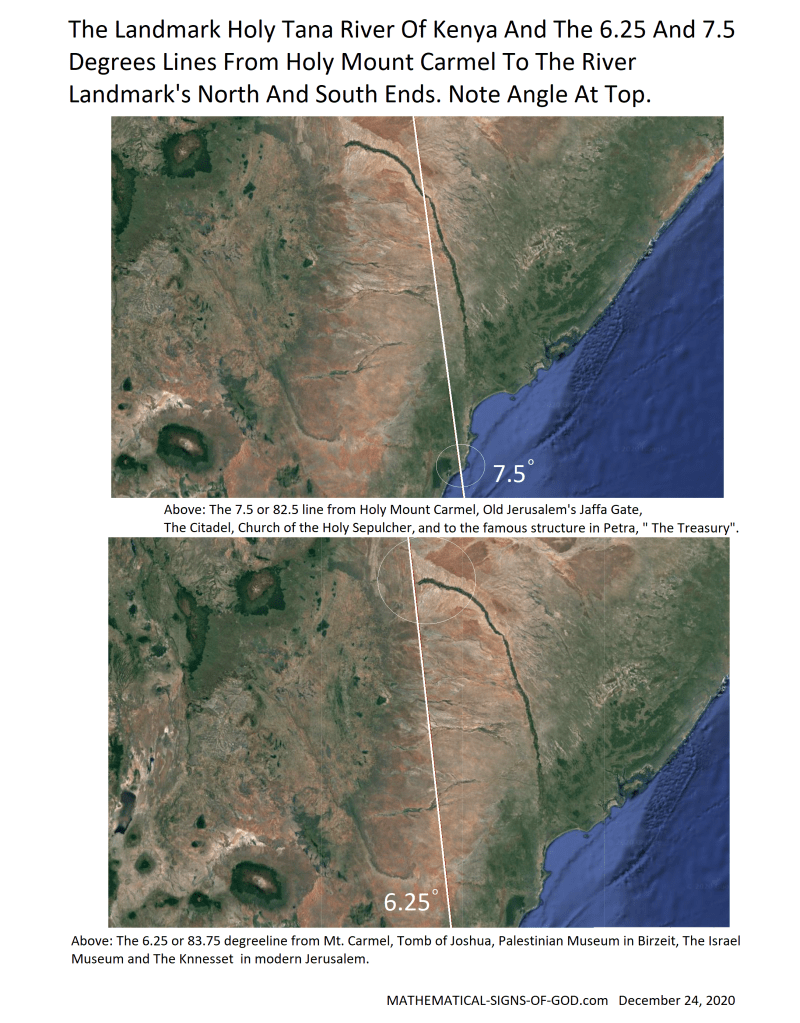
Visual south point of the curved river is beyond the rivers official end. See the river curve continue with the coast and the tree line, this is the visual end of this landmark.
Note the square shape of Holy Mount Kenya at top.
The top of Mount Kilamangaro has a vague teardrop shape in it. See pages